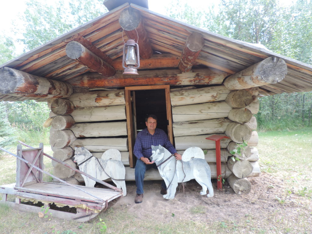
Great Northern Circle Route
Looking for a great summer road trip?
Look no further than the Great Northern Circle Route in Northern BC. This trip starts in Prince George, and follows Hwy 97 as far north as Watson Lake, Yukon, a distance of 1325.5 km (823 mi.), then south on Hwy 37 to Hwy 16, and back to Prince George, a total of 3188.51 km (1985.25 mi).
Here’s a short summary of our adventures:
- Wildlife – Grizzlies, bison, caribou, black bear, bobcat, moose (Stay in the car!)
- First Nations History (Gitwangak Battle Hill) and Kitwanga
- Unusual geological formations – (Liard Hot Springs, Erosion Pillar Trail, Whirlpool Canyon)
- Prehistoric adventures – (side trip to Tumbler Ridge)
- Lots of freshwater fishing and canoeing!
Facts and Figures
Our return trip from Victoria, BC, took 19 days. We drove an average of 5 hours a day, making this a leisurely trip with lots of time to enjoy the sights. Take advantage of the viewpoints and day use areas. They are often the best photo ops and have information about the importance or history of that particular site.
My husband, Bob, and I camped most of the trip, but other accommodations are available for non-campers. Do your homework and plan ahead! The Great North is sparsely populated, which means hotels are scarce. Some provincial parks rent trailers and cabins. Always have a contingency plan should something go awry. As it did with us.
The Journey Begins
Our first night on the road was Lac La Hache Provincial Park on Hwy 97. So beautiful! We hope to go back next year and really explore the area.
From Lac La Hache, we drove through the South Cariboo region to Prince George. We passed low-lying pastures with cows and horses, craggy cliffs, forests of tall pine and fir, many lovely ponds and lakes and abandoned wood cabins. Abandoned buildings always peak my curiosity and I stop and explore whenever I can.
Where the Circle Joins
We reached Prince George around lunch time and picked up food for the next few days. This is the start of the Great Northern Circle Route.
Prince George is a lovely town, with plenty to do. While we didn’t stick around long on this trip, previous stays in Prince George have included:
- Walking and biking in and around the city. My favourite is Cottonwood Island Nature Park. There is over 100 km of trails, so take your pick! http://tourismpg.com/activities/cottonwood-island-nature-park
- Lheidli Tenneh Memorial Park (check out the train ride!) http://tourismpg.com/activities/lheidli-tenneh-memorial-park
- The Exploration Place Museum & Science Centre http://www.theexplorationplace.com/
- Huble Homestead Historic Site https://www.hublehomestead.ca/
- Prince George Railway Museum http://www.pgrfm.bc.ca/
For the more adventurous there are private entrepreneurs offering
- Indoor and Outdoor Rock Climbing
- Horseback Trail Rides
- Canoe, Kayak and Paddle Boarding
So excited to have started on the Great Northern Circle Route!
We drove about 4 hours along Hwy 97 from Prince George, past Chetwynd, to Moberley Lake Provincial Park. Around Chetwynd, our 1988 Westfalia started to thump. As we neared Moberley Lake, the thumping had become very worrisome, and by the time we arrived at our campsite, we knew something was terribly wrong.

But we knew there was nothing we could at the moment, so we set up camp and put our canoe in the water. Worry about our troubles tomorrow.
Did I mention that our campsite was a waterfront campsite? Private and on the water!! It felt so good to get in the canoe with only fresh air surrounding us instead of being hemmed in by the walls of the van. For more on Moberley Lake Provincial Park, please check out my park blog.
Car Troubles
The next day we drove the camper back to Chetwynd, thumping all the way. Turned out the CV joints, which hold the axle to the wheel had rusted off. Or something like that. I’m not that mechanical. The point is the van was undriveable. Apparently, we were fortunate not to have destroyed the axle all together! Would take a week to get new CV joints to Chetwynd.
Bob and I spent about ten minutes venting our frustration and feeling sorry for ourselves, then mulled over our options. Decision – rent a car and take a side trip to Tumbler Ridge.
Not as easy as it sounds. The nearest car rental was in Dawson Creek, over 100 km away. The only bus passed through Chetwynd at 3 o’clock in the morning.
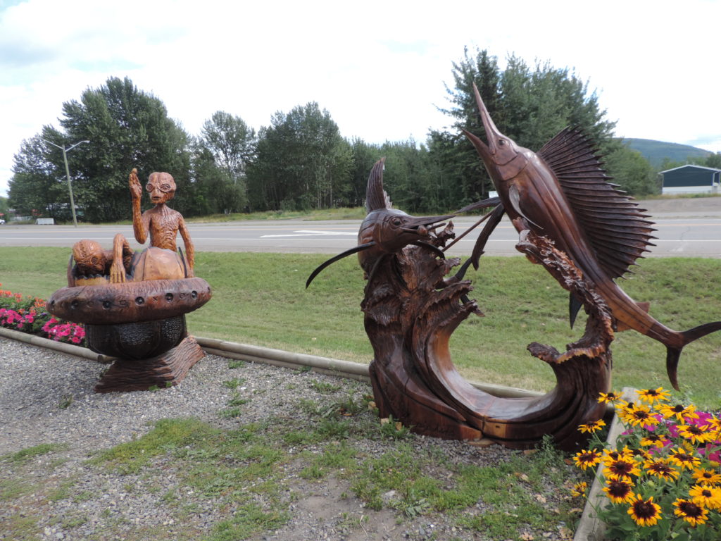
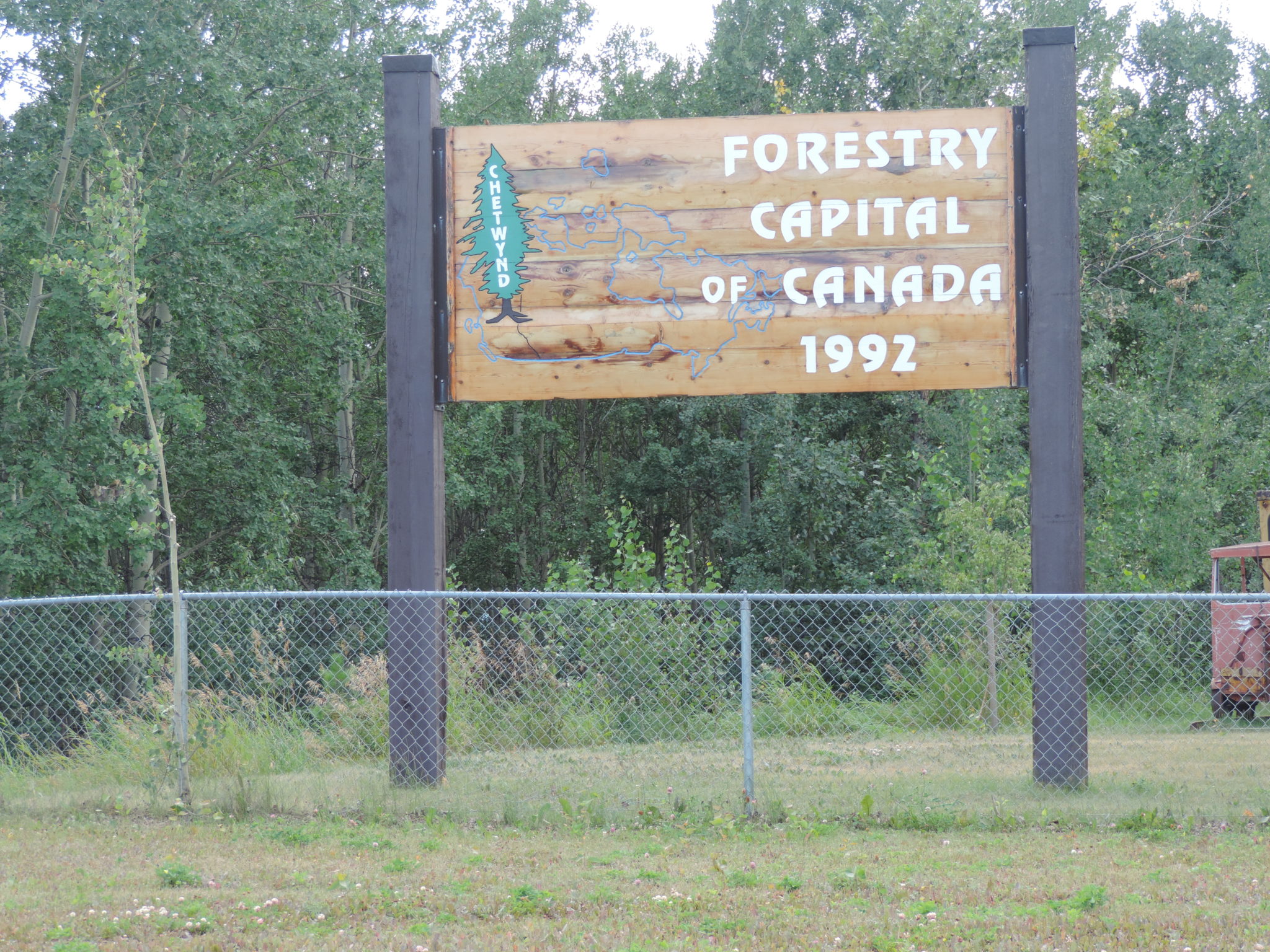
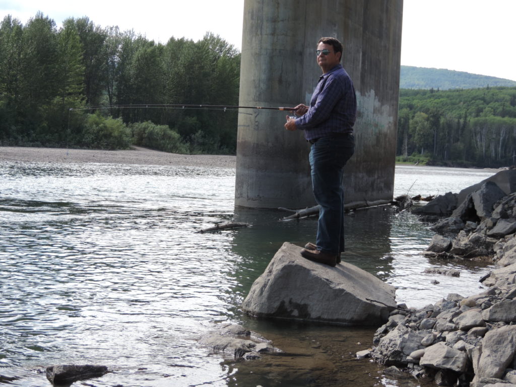
Not to be discouraged, we checked in to a hotel and spent the rest of the day wandering around Chetwynd (which is very small), visited the chainsaw carvings and fished in the local rivers.
There is a small Heritage Museum that is worth a stop. That evening we went to the local cinema and watched “Antman” with all of the local teenyboppers. It was a great movie that any Marvel fan will appreciate.
That night, my wonderful husband set the alarm for 2:30 am to catch the bus. I was enjoying a complimentary hot breakfast when he returned from Dawson Creek about 9:30, tired but quite satisfied with our rental car.
On the Road Again
We chose to take a round about way to Tumbler Ridge, via Peace River and the WAC Bennet Dam. This is a side trip off the Great Northern Circle Route, but one I highly recommend.
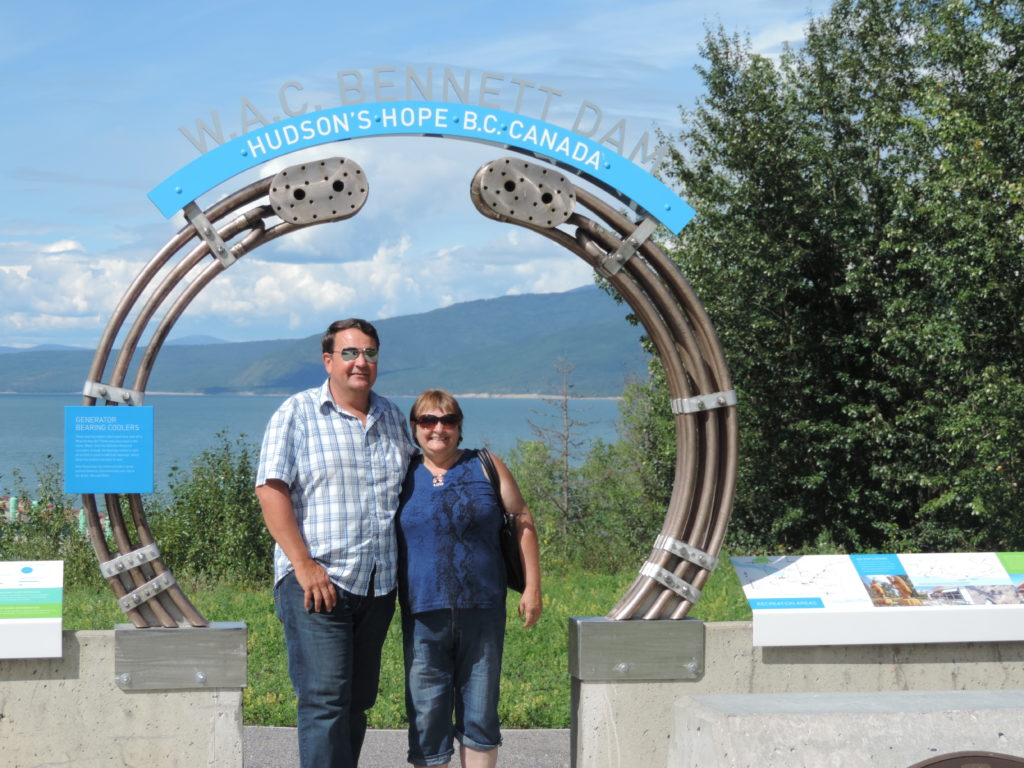
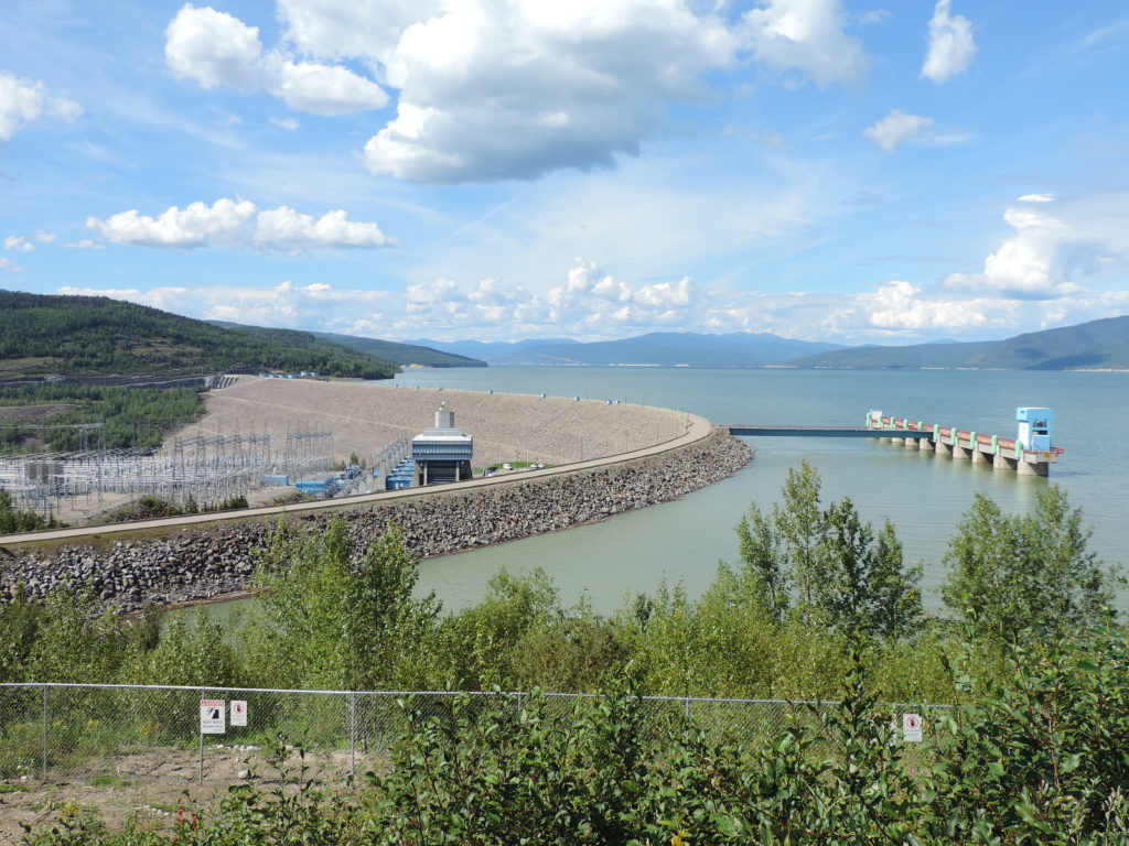
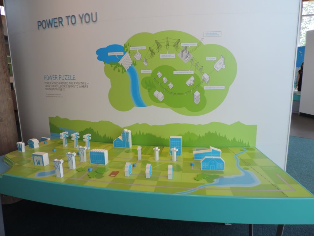
This elephantine structure is a marvel. The visitor centre includes hands-on exhibits demonstrating the workings of the dam, the path of electricity from the dam to your home, etc. Extremely well done. Even visiting young kids had a great time!
https://www.bchydro.com/community/recreation_areas/visitor-centres/wac-bennett-visitor-centre.html
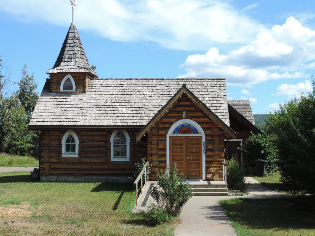
Hudson’s Hope
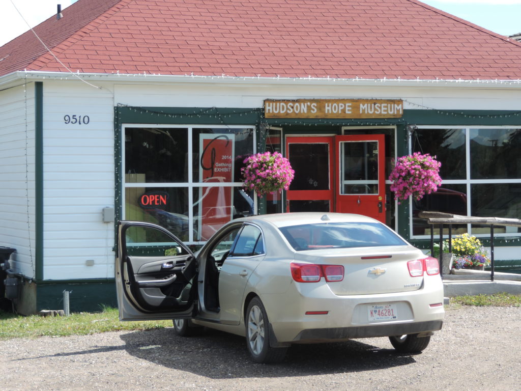
We stopped for a picnic at Hudson’s Hope. This is a very pretty town with a museum, pioneer cabins, etc.

The Peace River Region is one of the most beautiful regions in the province.
We spent the night in Fort St. John, then drove the slow route to Tumbler Ridge, stopping wherever we pleased and visiting several parks. For more info about the blogs, just click on the names.
Major Stops En Route to Tumbler’s Ridge
- McQueen’s Slough, a bird sanctuary, just outside Dawson Creek. We wandered the paths around the small lakes and tried to identify the birds and ducks. We heard the call of many birds hiding in the tall rushes, making beautiful music, but we couldn’t identify them.
- Kiskatinaw Provincial Park – a visit to the original Alaska Hwy, and the first wooden curved trestle bridge in Canada, and now the only one left in Western Canada.
- Swan Lake Provincial Park. A fine line of brush separated the campsites, and there wasn’t much privacy. The lake has pickerel and pike but is too cold for trout.
- One Island Lake Provincial Park. Wished we had our canoe with us! But it was still on the roof of our van in Chetwynd. Small, private sites on a lovely lake with, you guessed it! One small island in the middle.
From One Island Lake to Tumbler Ridge was quite the ride! We took the slower Hwy 52 route, a mix of paved and dirt/gravel, with hairpin turns and beautiful views. At one point a mama black bear and her 2 cubs walked out in front of us, causing Bob to slam on the brakes. She glared at us, making me feel very thankful we were in the car. I didn’t have my camera ready and missed the shot, and was no more prepared when a bobcat ran across the road. This guy I was ready for!
Tumbler Ridge – a hiker’s paradise
Tumbler Ridge (again, well off the Great Northern Circle Route) is a town with a rowdy past but an uncertain future. Once brimming with good paying jobs from the mines, the town was full of hope and expectation. Then the mines shut down. The jobs were gone. Now in a depressed economic state, the people of Tumbler Ridge are turning to tourism as a means to survival. And the opportunities abound! Check out the to-do list on this website. https://www.visittumblerridge.ca/Tumbler-Ridge/Activities
These are our faves:
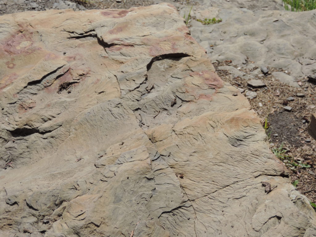
A hike along Flatbed Creek to the dinosaur tracks. The hike was beautiful, 4 km along a narrow path through forest and down a steep hill to the creek. Bob and I looked for tracks. We couldn’t find any until a local family arrived and point them out to us. We were standing right on top of them!
- Explored an old derelict cabin of sorts and identified a great variety of wild plants.
- The Dinosaur Discovery Centre. Well displayed casts of the dinosaurs’ footprints as well as casts of a full size tyrannosaurus-type dinosaur, a couple of ankylosaurs, a couple of smaller dinosaurs and several other wonderful displays. The centre also holds guided walks and lantern tours that are worth checking out. http://www.tumblerridgemuseum.com/dinosaurdiscovery.html
- Monkman Provincial Park, about 62 km from Tumbler Ridge. The main attraction is the beautiful cascading Kinuseo Falls along the Murray River. This is one of the campgrounds that I intend to come back to. So many hiking trails! Park blog here.
Leaving Tumbler Ridge
We stayed 3 nights in Tumbler Ridge then headed back to Chetwynd. On the way we stopped at “Bull Moose Marshes”. We didn’t see any moose but did see lots of birds. Winding canals flowed around islands of mud, marsh and tall grasses.
We also stopped to explore an old dilapidated cabin, climbing over logs and working our way through thorny brush. Abandoned cabins fascinate me. We looked for signs of its history but could find nothing. We can only imagine that the inhabitants were loggers, or trappers at one time…
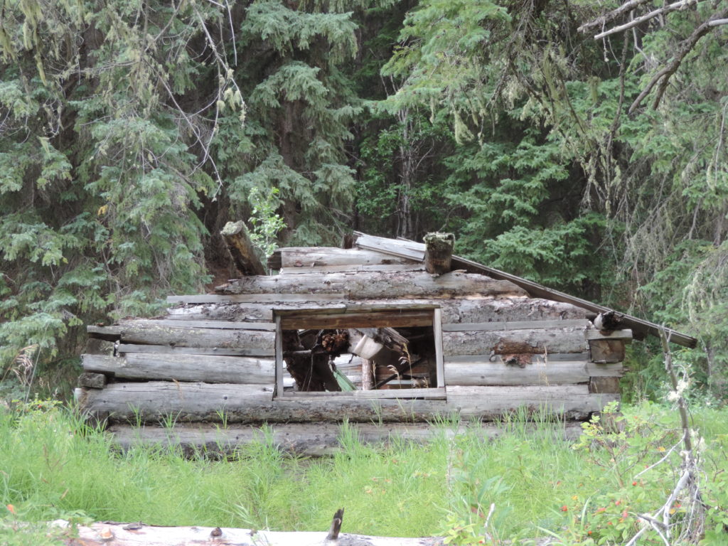
The next stop was Gwillam Lake Provincial Park. The viewpoint featured, not only magnificent views, but a history of the area. In amazement, we found ourselves looking at an old black and white photograph of a newly built cabin that looked exactly the same as the old cabin we had just stopped at! There was history there. My Gwillam Lake Provincial Park blog tells the story.
Back on the Great Northern Circle Route
By mid-afternoon we were back in Chetwynd. Our van was ready to go. It had been a great side trip, and I was almost grateful for our van troubles.
We drove back to Dawson Creek to drop off the rental car, and then on to Charlie Lake Provincial Park, just north of Fort St. John.
Left early the next day for Fort Nelson and Stone Mountain Provincial Park. We passed Buckinghorse Creek Provincial Park, a large open area for travelers to stop for the night on their way to the Yukon. We stopped in Fort Nelson long enough for provisions. When camping, we typically plan for three days of meals between trips to grocery stores.
Stone Mountain
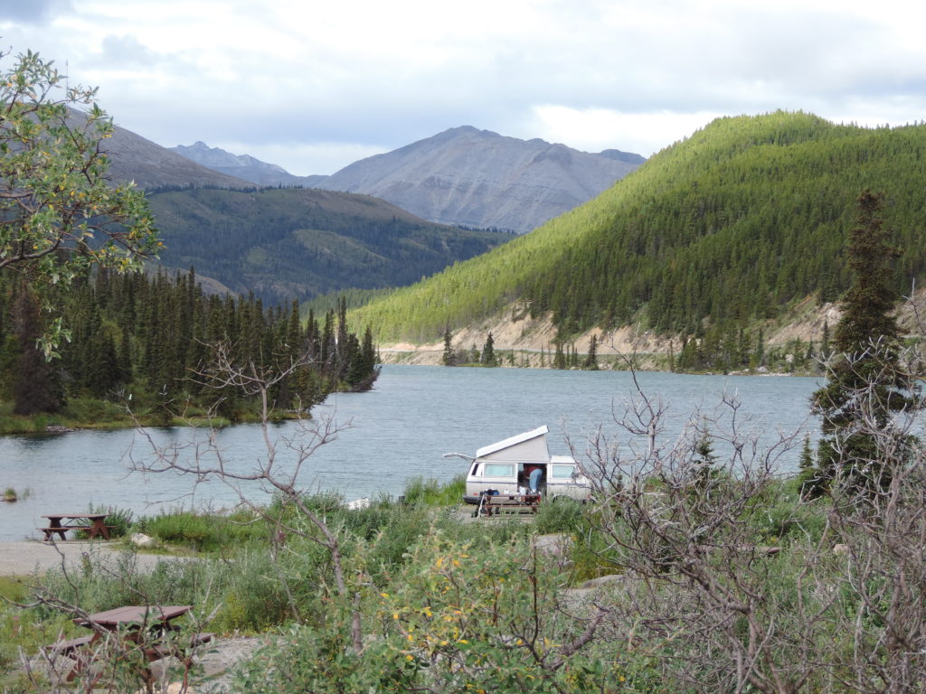
Stone Mountain Provincial Park is breathtaking! We spent two nights at Summit Lake campground, spending a day just enjoying and fishing the beautiful lake, and walking around the area. We had a waterfront campsite, and the canoeing was so peaceful. Summit Lake is just one of the beautiful areas in this park.
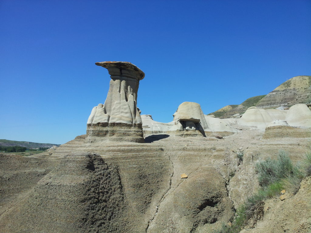
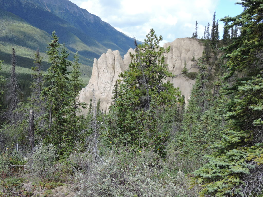
The day of our departure, Bob and I took our time packing the van. We wanted to enjoy this space for as long as we could. Then there was no more packing or tidying and we were on our way, heading for Muncho Lake Provincial Park. We stopped for a hike along the “Erosion Pillar Trail”. Apparently there are wonderful opportunities for wildlife viewing. It was a lovely walk. I had never seen anything like the erosion pillars. They were similar to the hoodoos in Alberta’s badland area, but different.
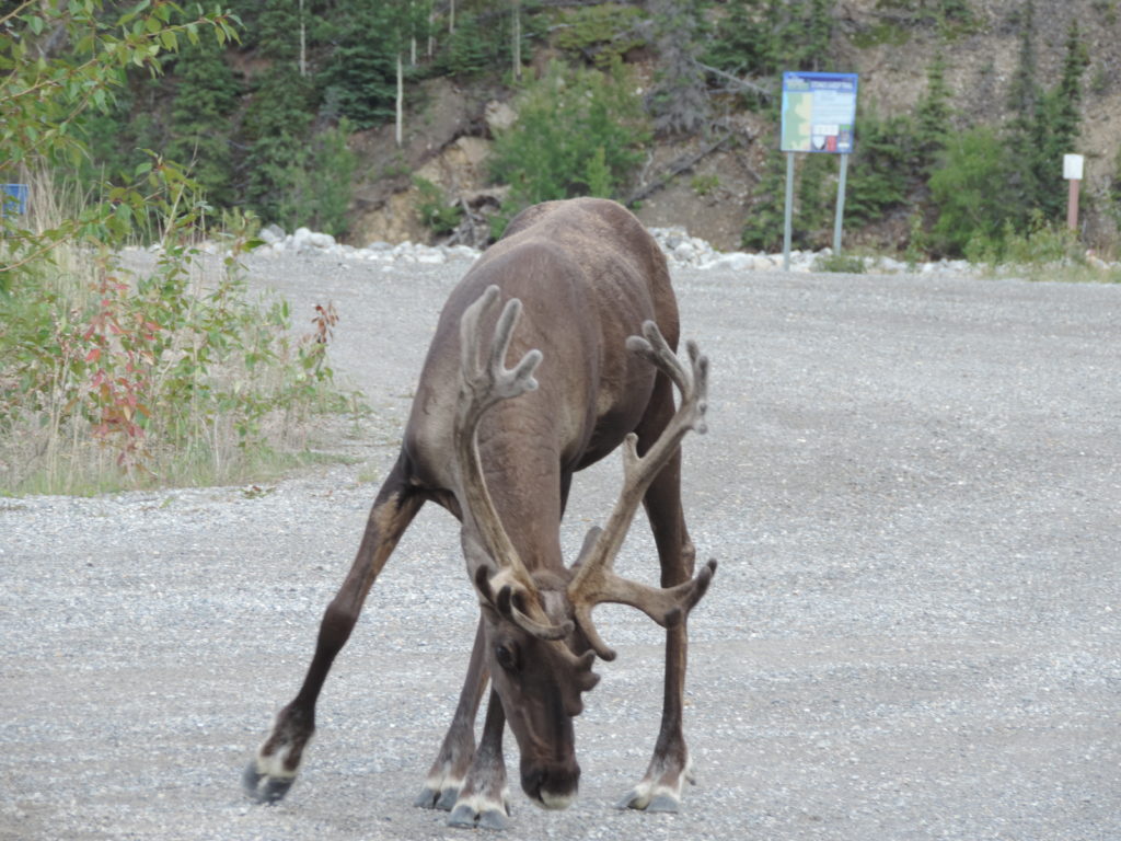
Stop for Caribou!
Our drive to Muncho was delayed by small groups of woodland caribou clustered along the side of the road and meandering across at their will. The woodland caribou is a “threatened” species under the Species At Risk Act.
(https://www.canada.ca/en/environment-climate-change/services/environmental-enforcement/acts-regulations/about-species-at-risk-act.
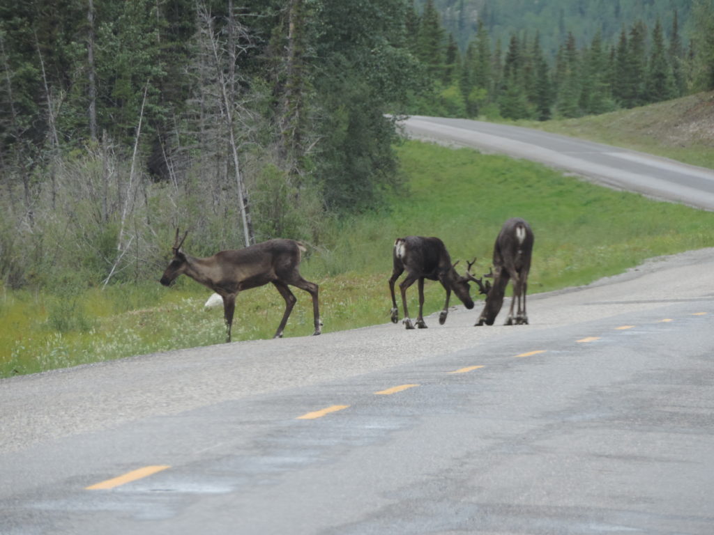
A fun fact – the woodland caribou is the only member of the ungulate family (hoofed grazers) that have antlers on both male and female. You can find more information about this threatened species and what is being done to increase their population in this great article: https://naturecanada.ca/what-we-do/naturevoice/endangered-species/know-our-species/woodland-caribou/
Muncho Lake Provincial Park

At Muncho Lake Provincial Park we snagged a waterfront site. More paddling! Please see my blog about this beautiful campground.
Our first adventure the next day was a short 1.5km hike along the Mineral Licks Wildlife Viewing trail, advertised as where to observe wildlife. We didn’t see any. We did meet a couple from Quebec and walked the trail with them, which discouraged large carnivores from getting too close. When it comes to bear safety, numbers count. You are less likely to surprise a bear when there are four of you. The closest thing to wildlife that we saw was a wolf track in some mud. Bob identified it as a Timber Wolf, and he is usually right about these things. Our new friends concurred. I found this fun animal track booklet online: http://www.oyccweb.com/uploads/2/6/4/4/26442920/animal_track_id_guide.pdf
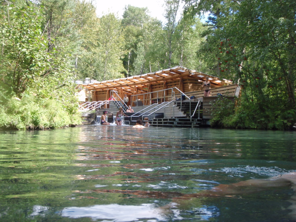
Liard Hot Springs
That afternoon we visited Liard Hot Springs Provincial Park. WOW!!! Please read about our adventures here: (hint – take your swimsuit!!) This park is a must-see, and if you don’t want to camp, there is a lodge at Muncho Lake. I don’t know anything about this accommodation, we didn’t even see the building! But here is the website: http://www.northernrockieslodge.com/liardhotsprings/
The next day we packed up and were off again, heading to Watson Lake, Yukon, and then south to Boya Lake. This is the most northern point on the circle route, but opportunities to go further north abound from Watson Lake.
This part of the trip should have taken us less than 4 hours, but there was so much construction on this stretch of the highway that it took us almost 7 hours. In hindsight, we should have spent a night at Watson Lake, but by the time we got there, Bob was tired, grumpy and not up to a change in plans. As a result, we missed out on most of the activities that I mention below.
Stop for Bison!
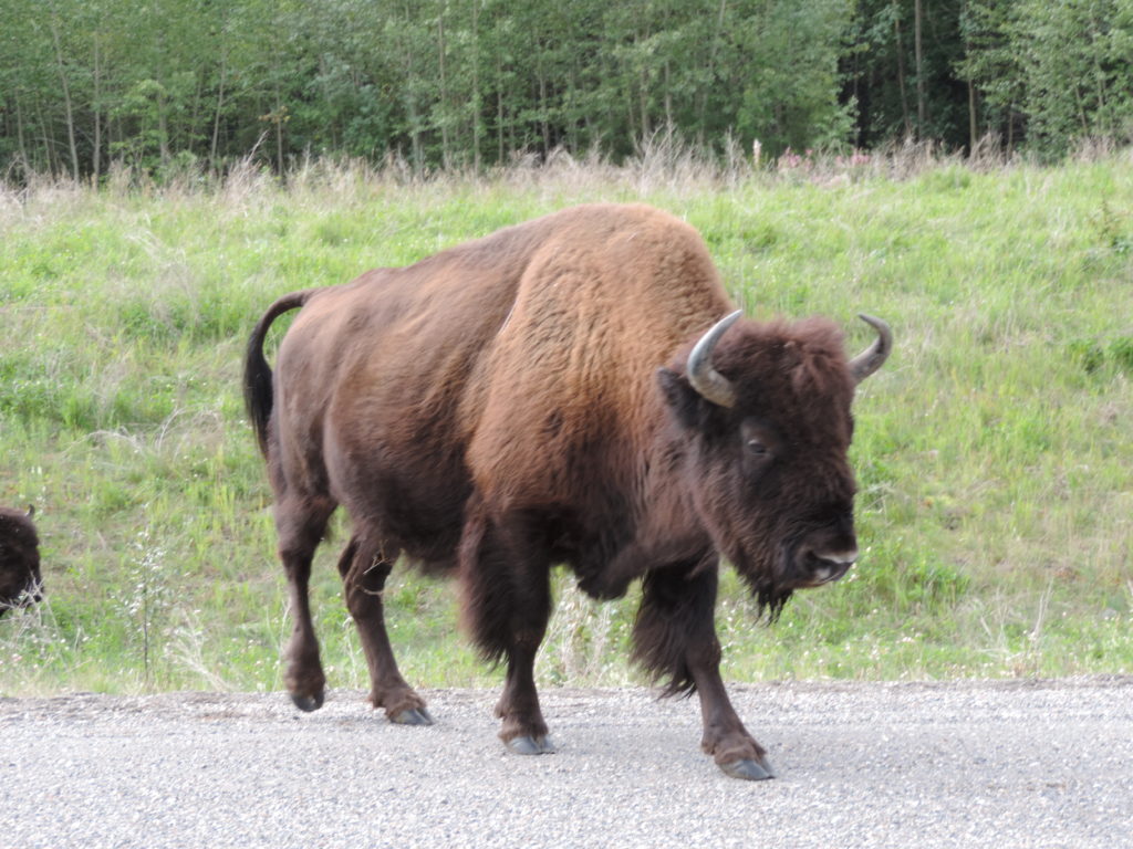
To be completely honest, it wasn’t just the construction that slowed us down, it was also the bison. Driving along in perfect weather and perfect driving conditions (before we hit the construction) we came across a roadblock. Several very large bison were meandering along the highway, zigzagging back and forth, munching on roadside vegetation. I was thrilled! I don’t know how many there were, maybe 10-15. Big bulls with full furry manes and very impressive horns, mamas with their babies, carefully watching each car and ready to charge if we made the slightest move toward them. The babies were so cute. The whole experience was exciting. The bison come very close to the cars, so keep your doors and windows close. They are very big animals and if frightened or upset can do serious damage to the vehicle or you.
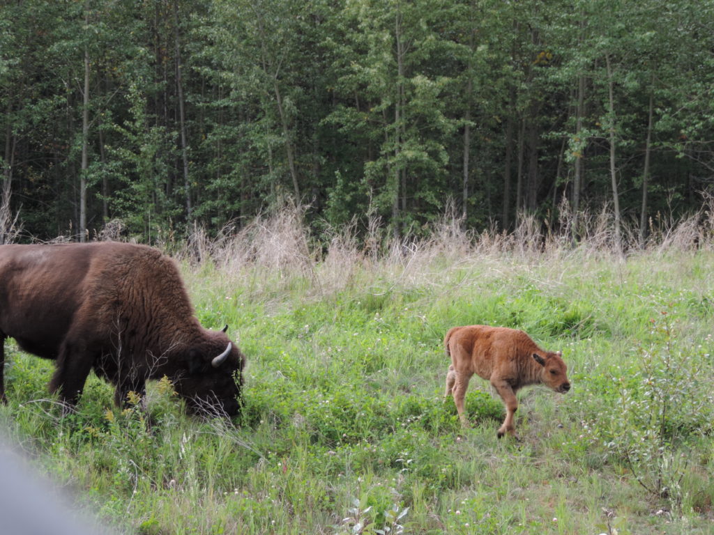
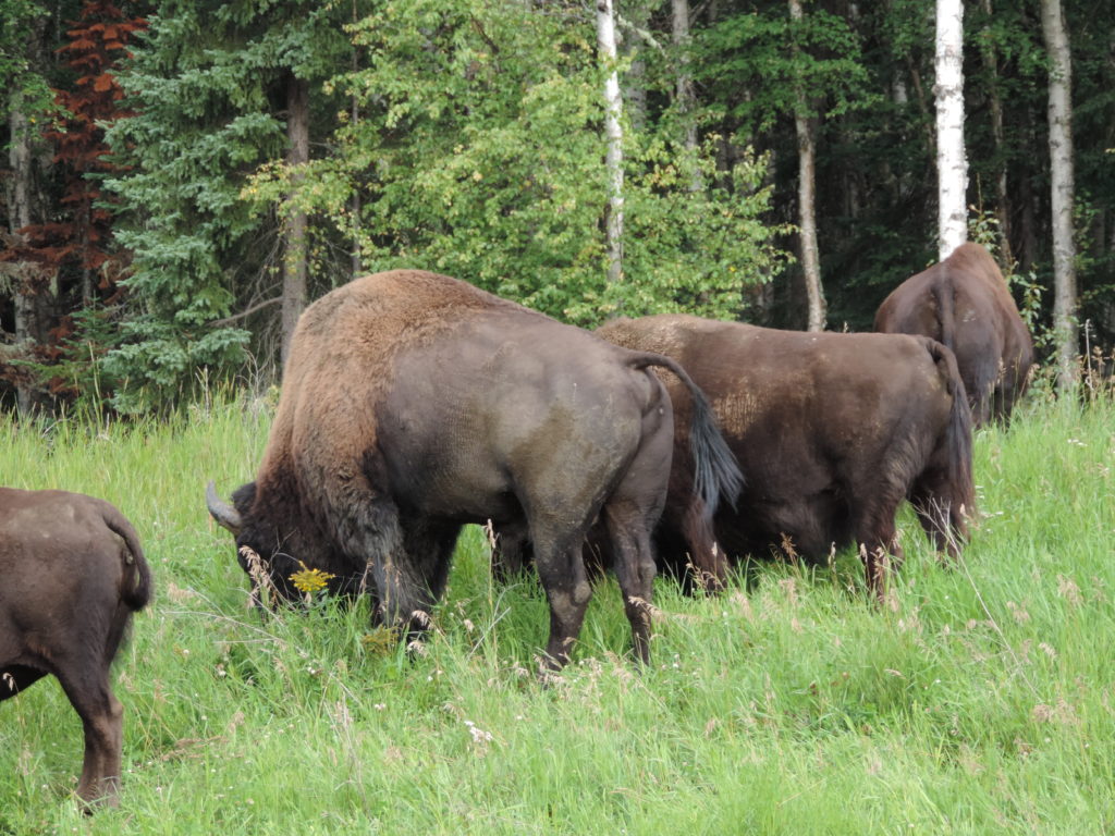
These bison have an interesting history. Wood bison are a “threatened” species. In this corridor they were pretty well extinguished through over-hunting and severe winters. Mostly over-hunting. A captive breeding herd was established at Elk Island National Park, and eventually enough bison were born to move a herd back here to their traditional land along the Liard River. I’m not sure why they congregate along Highway 97, but I’m pretty sure that is not where they were released.
If you want to learn more about the wood bison and what Canada is doing to increase the numbers, check out this webpage by Parks Canada
https://www.pc.gc.ca/en/nature/science/especes-species/liste-list/eep-sar3u#a2
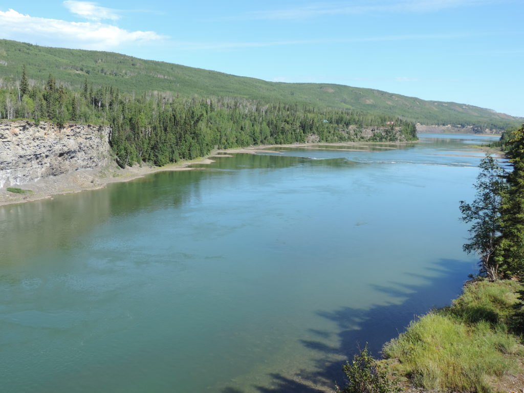
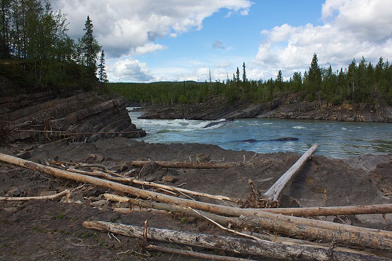
Whirlpool Canyon
The one other stop we made, and one that I highly recommend is Whirlpool Canyon. This is a rest stop just off Highway 97, but don’t plan on swimming!! A path from the parking area leads to the Liard River, where canyons and rocks force the water into rushing whirlpools. I had never seen a whirlpool before. I watched a log twirl like a baton, then get sucked down beneath the surface. A powerful testimony to the terrible and wonderful power of nature at work.
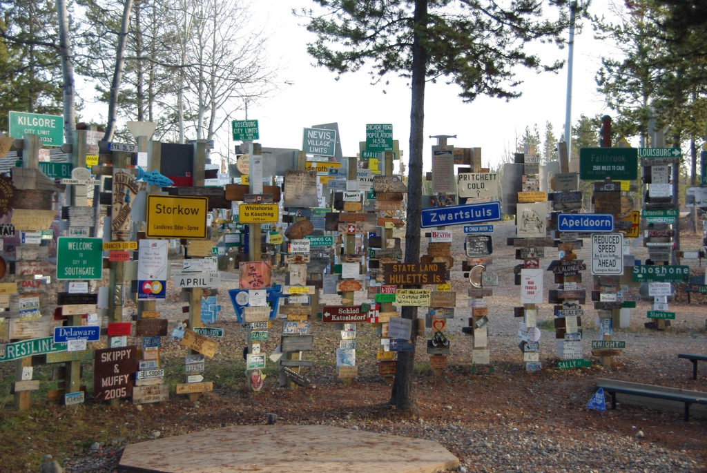
Watson Lake
The furthest north on the Great North Circle Route is Watson Lake. It was originally a US Army base for the engineers working on the Alaska-Canada Hwy in 1942. It was typical of the time for the army to erect directional posts with mileage markers to other bases in the area. Private Carl Lindley was tasked with repairing and painting the original post. He added a sign from his hometown of Danville, Illinois, starting a tradition that has led to the Signpost Forest, now with over 72,000 city, street and address signs from around the world. You can add your own sign. Either bring one from home, or make one at the Watson Lake tourist centre. But be sure to stop and see the Signpost Forest and get a real feel for global community.
The Northern Lights Space and Science Centre
The Northern Lights Space and Science Centre features panoramic video and surround sound of the Northern Lights. Summertime is not a great time to see the aurora borealis, and it would be a shame to drive all the way to the Yukon and not see them. The Centre also includes interactive displays, science and folklore surrounding Northern Lights, and the latest info about the Canadian Space Program.
Other Activities in Watson Lake
The Morgan Chaddock Recreation Centre has squash courts, weight room, 3 lane bowling alley, swimming pool and an ice rink (not sure if that is open in summer!), a youth centre with pool tables, air hockey and other activities and a toddler room. A great place for the whole family to burn off some steam built up during the drive, and calories from all that junk food! Plus – they offer showers to travelers!
Hiking, swimming, bird watching abound. Here are a couple of parks that are well worth the visit:
- Wye Lake
- Bird watching, picnic area and a 2.5 km walking trail along the lakeshore.
- Boardwalk, viewing platform, interpretive panels and look out
- Lucky Lake Park and Water Slide – slide is 500 feet long and drops 60 feet
- Sandy beach, hiking trails, fire pits, change rooms and washrooms.
- Liard River Canyon trail – 3 km trail to the Liard River canyon
Definitely enough to keep you and your family busy for a few days at least! Find out more at www.watsonlake.ca
Boya Lake Provincial Park
Within 2 hours of leaving Watson Lake, we were setting up camp at Boya Lake Provincial Park. We were tired, but still managed an hour or two of paddling in this remarkable lake.
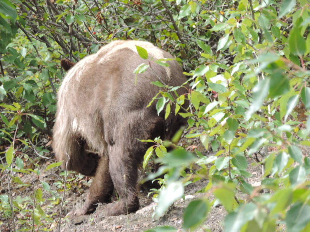
Grizzly Viewing
Left the next day, vowing to return for a longer period of time. We drove down the Stewart-Cassiar Highway, officially named Hwy 37. It was nice, but a bit boring. If you have time, spend a couple of days in Stewart and visit the Grizzlies at the Fish Creek Wildlife Observation Site in Hyder. https://www.fs.usda.gov/detail/r10/specialplaces/?cid=fsbdev2_038787 We had run out of time for side trips, so that is still on my bucket list!
Hyder is a small isolated community in Alaska with a population of less than 100. The only road in or out is through the border crossing and into Stewart BC. You will have to show your passport. There are no roads out of Hyder, and this is not a shortcut to the rest of Alaska.
Here is a wonderful article about Stewart/Hyder from the New York Times website. It will definitely make you want to visit!! https://www.nytimes.com/2016/07/03/us/canada-alaska-hyder-stewart-british-columbia.html
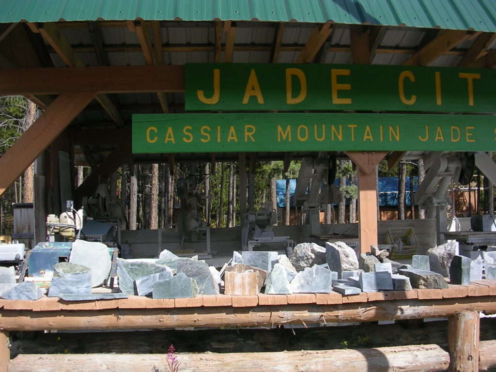
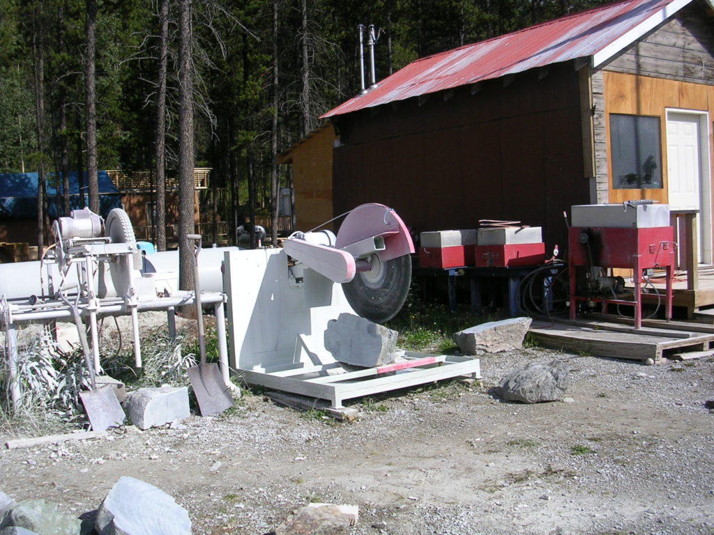
Jade City
The next Provincial Park was 9 hours driving (with stops, of course). With no stops it would have been 7 hours. My favourite stop:
- Jade City – a store on the highway that sells jade, rhodonite and hematite products. Displays of huge jade rocks and the equipment used to cut jade, as well as some history. Lots of cool stuff. This is also the setting for a reality T.V. show called “Jade City”. I never saw the series, but if you have, you would definitely enjoy seeing this place

Jade City Store Image Credit: Barbara Sibbald Jade City Displays Image Credit: Barbara Sibbald
Meziadin Lake Provincial Park
That night at Meziadin Lake Provincial Park was the first night that I was able to sit by the fire and not be cold. A beautiful park. Check it out here.
Gitwangak Battle Hill and Kitwanga
On the drive to Smithers we stopped at the Parks Canada Historic Site, Gitwangak Battle Hill. This is the site of the fortified village of the Gitwangak people, and one of the First Nations hero stories. The story began when a man from an enemy tribe kidnapped a young woman of the Gitwangak for his slave/wife. One night, while the man was sleeping, the woman cut off his head and stole away with her baby back to her family. The child, ‘Nekt, grew to be a great warrior and chief. Interpretative signs along the walk tell the tale about this hero, and the history of the area.
The site is exceptionally maintained and well-marked. You can see it all in about ½ an hour.
Find out more: http://www.pc.gc.ca/en/lhn-nhs/bc/gitwangak/info
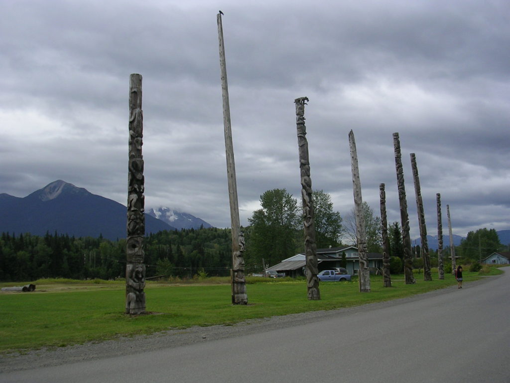
Nearby, in the town of Kitwanga, where the Gitwangak now reside, there are some old totem poles that commemorate the history of the original village. Well worth the stop.
Seeley Lake Provincial Park
A good place to stop for lunch or just a rest is Seeley Lake Provincial Park with picnic tables right beside the lake at the day use area. There are also 20 non-reservable campsites, but I can’t comment on them because we have never stayed there. Just lunched.
When we reached Smithers we took a break from camping and spent the night in a hotel. Too tired to even walk around, we spent the evening stretched out on our king-sized bed and watched movie.
Ten Mile Lake
Early to rise the next day and off to Ten Mile Provincial Park. It was a 6-hour drive and since we had left so early we arrived at Ten Mile early in the afternoon. We parked the van and walked around the campground. The campsites were very nice, well-shaded and private.
Near the beach we saw a sign promising ice cream at the end of the trail. I dragged my husband and his wallet through the well-marked trail to a privately-owned piece of property. And sure enough, there was an ice cream stand that served whopping big cones. The proprietor also owned a waterfront RV campground with a dock, firepits, water, and did I mention right beside the water? Within a few minutes Bob had returned with the van and we were setting up just a few feet from the beautiful Ten Mile Lake. Waterfront property with a million-dollar view!
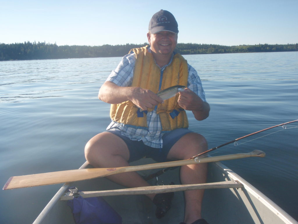
That evening, we paddled to the day use area at Ten Mile Point Provincial Park and had a lovely swim. We fished on the way back to our camp and Bob caught 2 small rainbow trout. He was happy. The lake was well-used with a lot of power boats and tubers, but it is a big lake and there was lots of room for everyone.
That was our last night camping on this trip. It was a great road trip with lots of sights, adventures, and paddling. We completed the Great Northern Circle Route and drove from the most southern tip of BC to the most Northern, and into the Yukon. If you are thinking of taking this trip be prepared for a lot of driving and a lot of adventure!
A Couple of Warnings
- One note about weather in this area of BC: even though it is late July, the evenings are very cool, and a toque is helpful. Sitting by the campfire in the evening even called for my long underwear!
- We were startled to see many overnight rest stops and gas stations had closed since my research the previous year. As for gas, my advice is once you leave Fort St. John, don’t pass an open gas station without filling up (and using the facilities if available). We drive a 1988 VW Westfalia, that averages about 10 km/litre. If you drive a guzzler like ours, I recommend carrying an extra can of gas.
Links to Provincial Park blogs from this trip
Boya Lake
Buckinghorse Creek
Charlie Lake
Gwillam Lake
Lac La Hache
Meziadin Lake
Moberley Lake
Monkman Lake
Muncho Lake
One Island Lake
Seeley Lake
Stone Mountain
Swan Lake
Ten Mile Lake
Here is my growing list of the parks visited as I continue my quest to visit all 648 BC Parks!!