Well’s Gray PP
Are you a waterfall enthusiast? Well’s Gray Provincial Park is the place for you! With 42 named waterfalls, several with viewing sites a short jaunt off the main road, Well’s Gray has waterfalls for everybody. An entire summer can be spent exploring this park, with its backcountry camping, hidden waterfalls, 200 kms of trails, front country park campgrounds, and water sports galore in the Clearwater River, Clearwater Lake, Falls Creek and Mahood Lake. Camping not your thing but still love to experience the outdoors? Stay in one of the many hotels, bed and breakfasts, ranches and resorts in the area. My husband Bob and I stopped in Clearwater on our way home from visiting our kids in Edmonton. It was only April, and too cool for camping (in my opinion!), so we stayed in a motel in town. Check at the end of this blog for links to accommodations in the area.
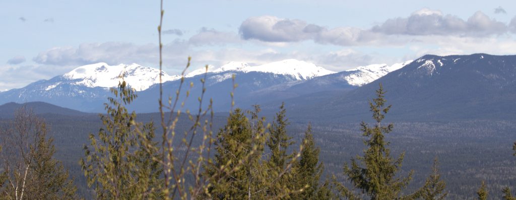
Image by Barbara Sibbald
Wells Gray Provincial Park is accessed from Clearwater, about 225 km north of Kamloops, BC, on Highway 5. Turn onto Clearwater Valley Rd at the roundabout. Do stop at the Visitor Information Centre. They have all the information you didn’t know you needed! The kind staff stocked us up with information and maps, and alerted us to the fact that the park road is closed to vehicle traffic from September to May. Fortunately, there was plenty to see before the roadblock.
Highlights
The rivers, lakes and mountains of Wells Gray Park were created by volcanic eruptions followed by periods of cooling, followed by retreating glaciers. These heating, cooling, warming periods produced some amazing geological features, many of which can be viewed from the rest stops along Clearwater Valley Rd.
Our first stop was the Spahats Creek Falls. Water drops 75 meters through a rocky volcanic keyhole into a layered lava canyon. So beautiful! A lovely new viewing platform and walkway makes the trip safe and accessible for those with limited mobility.
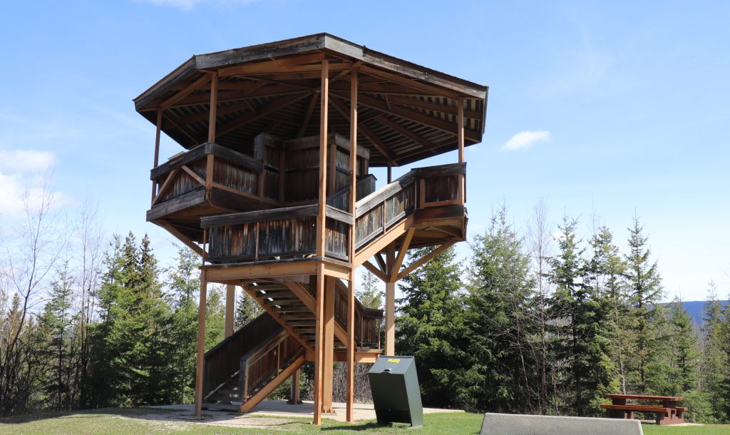
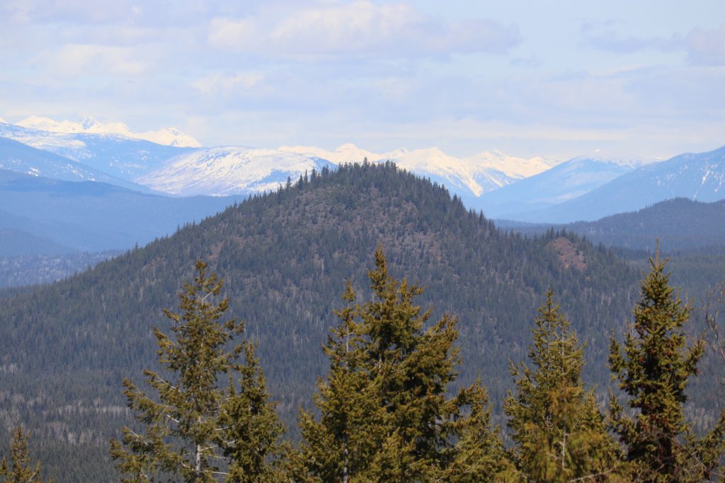
Next stop – Green Mountain Lookout Tower, with its 360 degree view of the entire Clearwater Valley.
You can see several extinct volcanoes from the lookout. My favourite is the Pyramid Mountain that erupted 12,000 years ago. From the tower, you can see the small, steep, conical volcano, known as a cinder cone. Pyramid Mountain is not the largest in the area by any means, but is the easiest to recognize. I found out later that there are opportunities to hike to the top of this mountain along a 10km path.
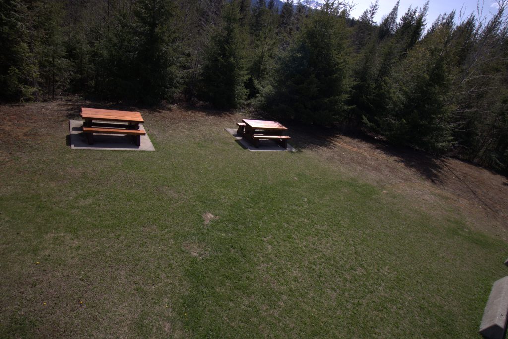
The site of the tower also has a lovely field with picnic tables and a pit toilet. From here you can walk the trail to Foot Lake and White Horse Bluffs. We might look into that if we get back to the park for a longer visit.
mage by Barbara Sibbald
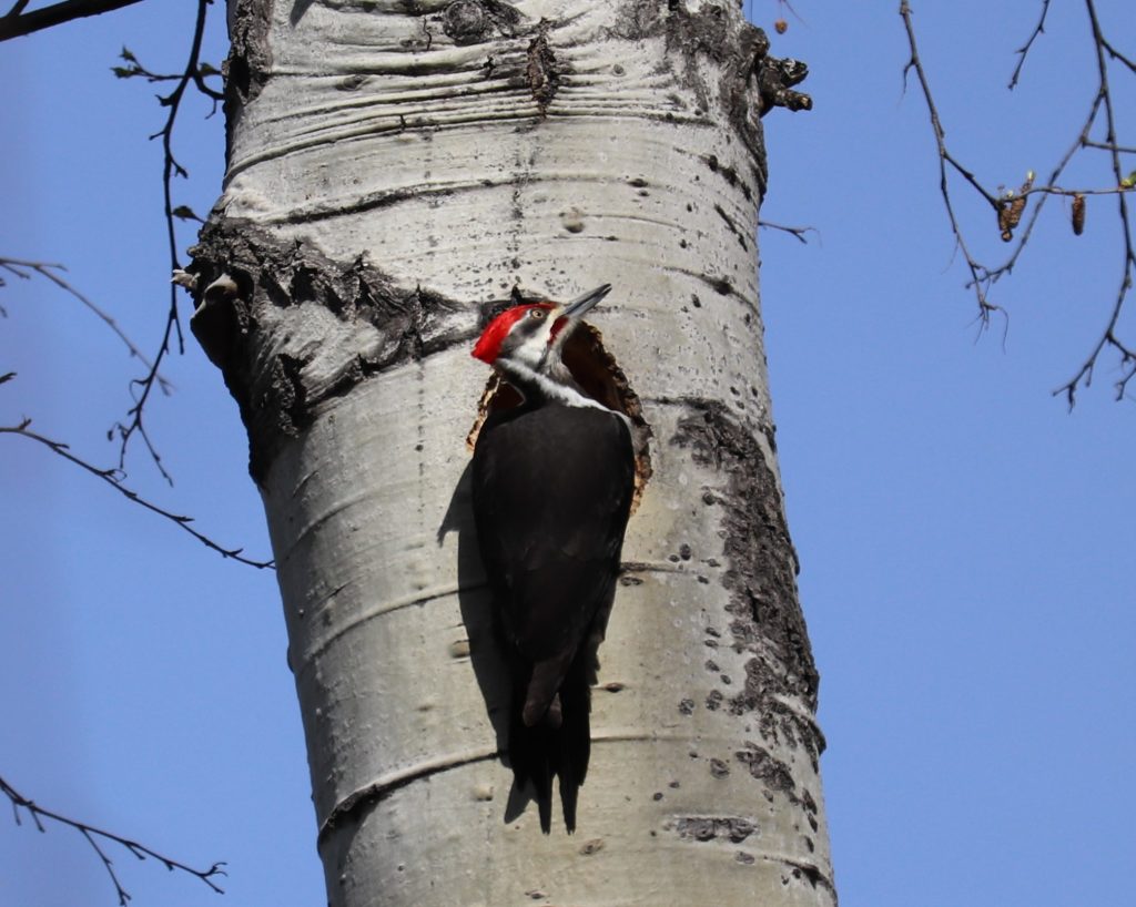
Moul’s Falls is at the end of a 3km trail through forest. This path is well maintained, but does have lots of exposed roots and rocks. But what a great spot for birders! We saw a pileated woodpecker building a nest in the tree. We watched it swoop to the tree, then climb into the hole. A moment later wood chips were flying out of the hole, accompanied by the bird’s unmistakable drumming sounds. There were several smaller birds as well, singing to us as we walked down the trail. Unfortunately, Bob and I had limited time, so we chose to turn around halfway down the trail, before we reached the falls.
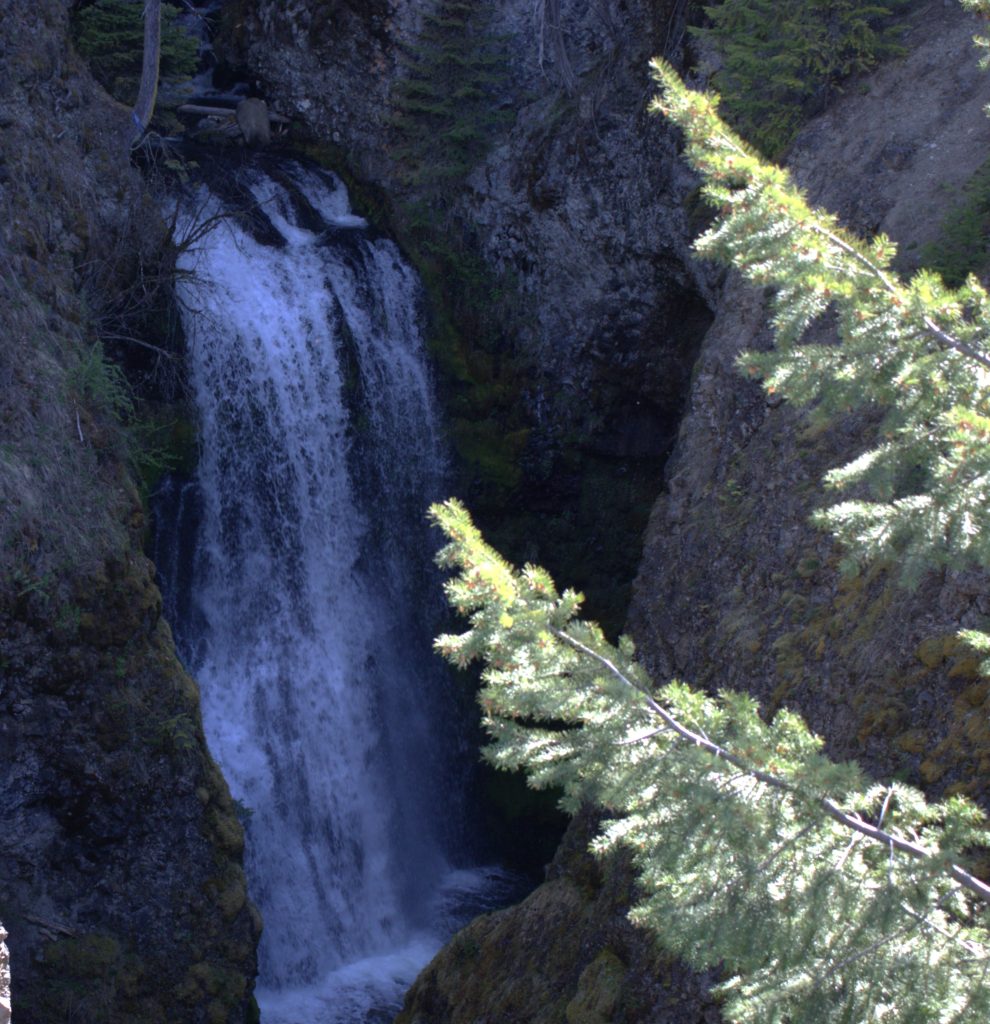
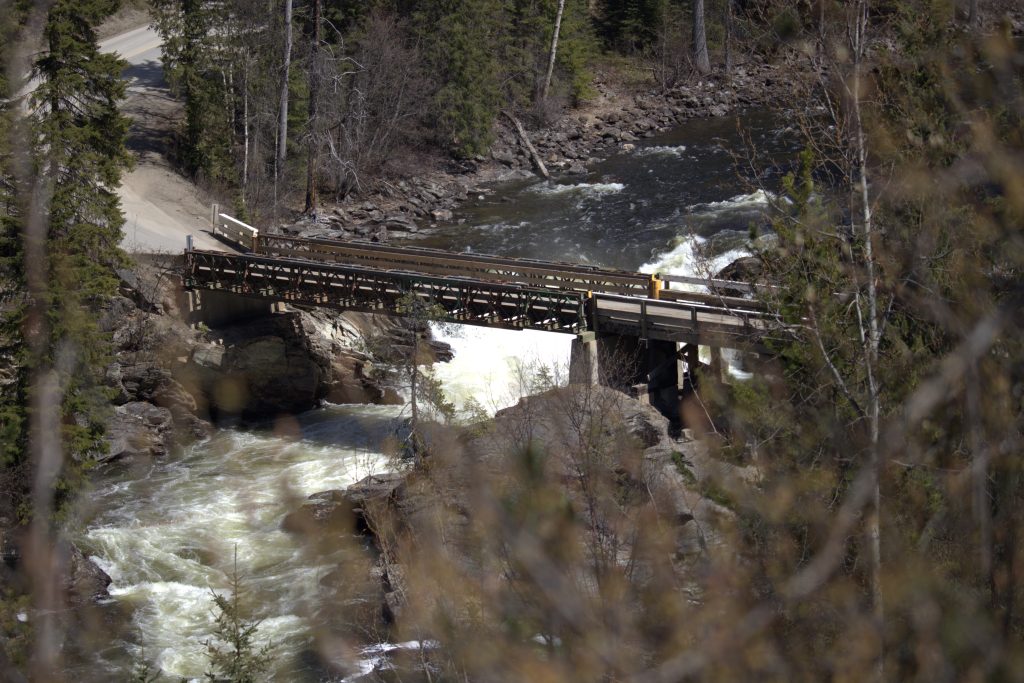
Further up the road, Dawson Falls, Mushbowl and Helmcken Falls are grouped quite close together.
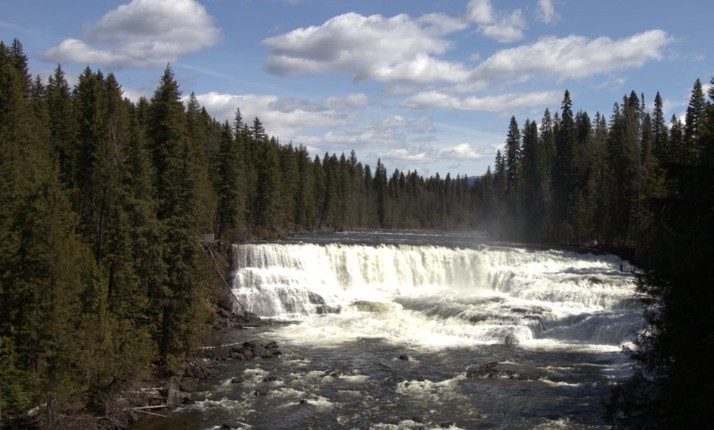
Dawson Falls is 107 m wide (351 ft) and drops over 200,000 year old lava flows from a height of 18m (about 60 ft). Very impressive, very beautiful and very loud!
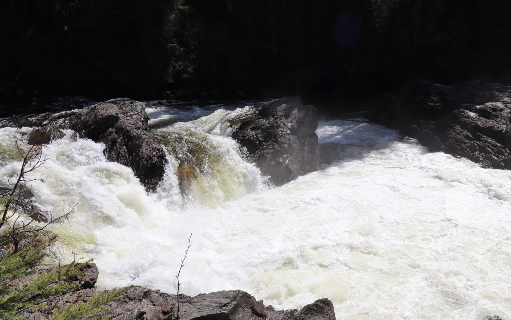
The Mushbowl is a small waterfall sandwiched between the Helmcken Falls and the Dawson Falls. At this point, the broad river is pinched to about 50m, with a huge rock splitting the river in half. It is a drop of only 5m, or just over 15 ft, but the amount of water running over the drop creates a violent, swirling and churning pool of water. To visit this site, simply turn at the marked turnoff, cross the bridge and pull over to the side of the road. There is room for about 3 cars.
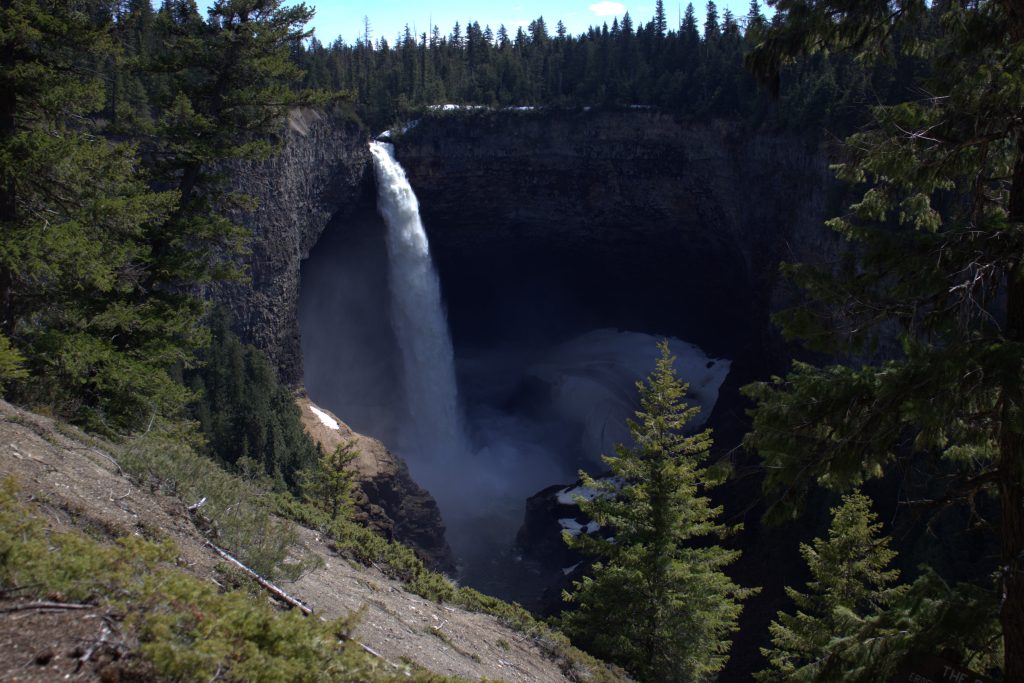
The most famous of the falls in Wells Gray Provincial Park is Helmcken’s Falls, the 4th largest waterfall in Canada. Water drops 141 m (463ft) down a circular cliff created by flowing lava over 10,000 years ago. You can easily view this spectacular land formation from the viewing platform a very short walk from the parking lot.
And it was at this point that the Clearwater Valley Road closed for the winter. It had been an exhilarating day, exploring the beautiful sites that rose out of Nature’s most violent episodes. I hope you can visit this park, with its endless nature experiences. For more information check the links below.
The World Waterfall Database (yes, there really is such a thing, check it out here): https://www.worldwaterfalldatabase.com/country/Canada/British-Columbia/list
List of some of the accommodations in the area:
Wells Gray Provincial Park and the BC Parks website:
What to do in Wells Gray Provincial Park:
Some information about the the Deep Snow Mountain Caribou